
News From Nowhere Radical & Community Bookshop
not-for-profit - a workers'co-op - committed to social justice | 96 Bold Street, Liverpool L1 4HY - 0151 708 7270
Bootle Docks and Seaforth 1907. Lancashire Sheet 99.13 (Facsimile of old Ordnance Survey Map)
by Introduction by Mike Greatbatch - £3.50 Alan Godfrey Maps (1989)
other format
ISBN 13: 9780850542455 | ISBN 10: 0850542456
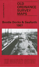
This detailed map is double-sided for maximum coverage. The main map, sheet 99.13, covers much of Seaforth, together with part of north Bootle, including Linacre Ward.
Coverage stretches from the coast inland to Salisbury Road, and from Narrowby Road southward to Aber Street. Features include Seafield Convent, Seaforth Hall, St Thomas church, Overhead Railway, LYR railway with Seaforth Sands station, Fazakerley & North Mersey Branch, LYR Liverpool-Southport line with Seaforth station, north part of Alexandra & Langton Docks goods station, St Leonard's church, tramways, Arley House, Bowersdale Park etc. On the reverse we include adjacent sheet 106.01 which extends coverage southward to include some of the docks: Hornby Dock, Alexandra Dock, Langton Dock, Brocklebank Dock, Overhead Railway with several stations, Bootle Borough Hospital, Langton Graving Docks, LNWR Alexandra Dock Goods Station, St Mary's church, North Mersey & Alexandra Docks Goods Station etc.
This map links up with sheets 99.09 Waterloo to the north, 99.14 Bootle North and 106.02 Bootle to the east.
(Price & availability last checked: July 2023)
© News From Nowhere Co-operative Ltd IP24524R 2004-2024 | Privacy policy | Contact | return to top of page