News From Nowhere Radical & Community Bookshop
not-for-profit - a workers'co-op - committed to social justice | 96 Bold Street, Liverpool L1 4HY - 0151 708 7270
Liverpool (North) 1906. Lancashire Sheet 106.10b (Facsimile of old Ordnance Survey Map)
by Introduction by Naomi Evetts - £3.50 Alan Godfrey Maps (1990)
other format
ISBN 13: 9780850542950 | ISBN 10: 0850542952
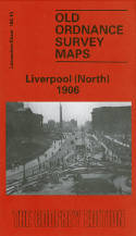
This map is double-sided to provide maximum coverage. It covers a major northern part of the city, with coverage stretching from King Edward Street eastward to Everton Road, and from Conway Street southward to William Brown Street.
Features include Walker Art Gallery, Library & Museum, Tobacco Manufactory, Wholesale Fruit Market, Victoria Square, St Anthony's RC church, tramways, St Augustine's church, Rupert Lane Barracks, Liverpool College, western part of Everton, St Anne's Ward, South Scotland Ward, Vauxhall Ward, LYR railway with Exchange station, Exchange Station Junction, Great Howard St Goods Station, LNWR Waterloo Goods Station tunnel shown, David Lewis Northern Hospital, Leeds & Liverpool Canal etc.
This map links up with sheet 106.06 Kirkdale to the north, 106.11 Newsham Park to the east, 106.14 Central Liverpool to the south.
(Price & availability last checked: July 2023)
© News From Nowhere Co-operative Ltd IP24524R 2004-2024 | Privacy policy | Contact | return to top of page