
News From Nowhere Radical & Community Bookshop
not-for-profit - a workers'co-op - committed to social justice | 96 Bold Street, Liverpool L1 4HY - 0151 708 7270
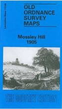
Mossley Hill 1905. Lancashire Sheet 113.08a (Facsimile of old Ordnance Survey Map)
by Introduction by Naomi Evetts - £3.50 Alan Godfrey Maps (1992)
other format
ISBN 13: 9780850545203 | ISBN 10: 085054520x
Alan Godfrey have published two versions of this map (1905 and 1925), showing how the area changed across the years.
The maps cover much of the Mossley Hill area SE of Liverpool, including portions of Aigburth, Garston and Allerton. Coverage stretches from St Anne's Road eastward to Allerton Road, and from Palmerston Road southward to Aigburth Hall Road.
Features include Holmfield, Garston Old Vicarage, LNWR railway with Mossley Hill station, St Anne's Crescent, Carnatic Hall, Elmwood Hall Laundry, streets being developed around station, Forty Pits, West Farm, Maryton Grange, Drygrange; east of the railway the land is largely rural with some villas around Allerton Road. On the reverse they include street directory entries for Allerton Road, Elmswood Road, Greenhill Road, Mossley Hill Road.
This map links up with sheet 113.04 Allerton to the north, 113.07 St Michaels to the west, 114.05 Woolton to the east and 113.12 Garston to the south.
(Price & availability last checked: July 2023)
© News From Nowhere Co-operative Ltd IP24524R 2004-2024 | Privacy policy | Contact | return to top of page