
News From Nowhere Radical & Community Bookshop
not-for-profit - a workers'co-op - committed to social justice | 96 Bold Street, Liverpool L1 4HY - 0151 708 7270
Anfield 1908. Lancashire Sheet 106.07 (Facsimile of old Ordnance Survey Map)
by Introduction by Naomi Evetts - £3.50 Alan Godfrey Maps (1994)
other format
ISBN 13: 9780850546729 | ISBN 10: 0850546729
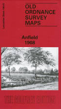
Alan Godfrey have published two versons of this detailed map (1890 and 1908), showing how the area developed across the years. The 1890 map is fully coloured, taken from the beautiful 1st edition OS handcoloured map.
The maps cover the Anfield area on the north side of Liverpool, with coverage stretching from Liverpool football ground eastward to Lisburn Lane, and from New Hall Lane southward to Esmond Street.
Features include tramways, many streets of terraced houses, Belmont Road Workhouse, Liverpool football ground, part of Stanley Park, south part of Liverpool Cemetery, Holy Trinity church, fever hospital, Advent Church, Hydraulic Engineering Works, Clubmoor, Tue Brook, St John the Baptist church, Tue Brook House, Lisburn Farm etc.
Each map includes extracts from an early directory together with a specially written introduction to the history of the area.
This map links up with sheet 106.03 Walton to the north, 106.06 Kirkdale to the west, 106.08 West Derby to the east and 106.11 Newsham Park to the south.
(Price & availability last checked: July 2023)
© News From Nowhere Co-operative Ltd IP24524R 2004-2024 | Privacy policy | Contact | return to top of page