
News From Nowhere Radical & Community Bookshop
not-for-profit - a workers'co-op - committed to social justice | 96 Bold Street, Liverpool L1 4HY - 0151 708 7270
Liverpool (Hanover Street) 1848-1864. Liverpool Sheet 29 (Facsimile of old Ordnance Survey Map)
by Introduction by Kay Parrott - £3.50 Alan Godfrey Maps (2003)
other format
ISBN 13: 9781841515144 | ISBN 10: 1841515140
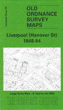
This wonderfully detailed map covers the area of Liverpool around Hanover Street and Canning Place.
Coverage stretches ftrom Canning Dock eastward to Slater Street, and from Lord Street southward to Lydia Ann Street. Features include the Canning Dock, much of Salthouse Dock and Albert Dock, Custom House, St George's church, St Thomas's church, Sailors' Home, St Peter's church, Pedlar's Market, Blue Coat Hospital, and the many streets and alleys off Hanover Street, Lord Street, Church Street, Duke Street, Strand Street etc. On the reverse we include selections from a street directory, incl Canning Street, Duke Street, Hanover Street, Paradise Street, Pitt Street, Seel Street, South John Street.
The map links up with Liverpool Sheets 23 Liverpool Pierhead to the west, 24 Dale Street to the north, 30 Mount Pleasant to the east and 34 Liverpool Wapping to the south.
(Price & availability last checked: July 2023)
In booklists: Alan Godfrey Maps,
In categories: History & Biography, Local Interest,
© News From Nowhere Co-operative Ltd IP24524R 2004-2024 | Privacy policy | Contact | return to top of page